
Atlanta is not a city most people associate with flood risk. There are no coastlines, no hurricanes making regular landfall, and no tidal surges to worry about. But the Chattahoochee River runs directly through some of the most expensive residential real estate in the Southeast, and Peachtree Creek winds through the heart of Buckhead. Both waterways have flooded before, and they will flood again.
For luxury homebuyers spending $1.5 million, $3 million, or $8 million on a property, flood risk is not something you can afford to overlook. According to FEMA flood map data, portions of several premier Atlanta neighborhoods fall within designated flood zones. That does not make them unbuyable. It means you need to do your homework before writing an offer.
This guide covers everything a luxury buyer needs to know about flood zones in metro Atlanta: where they are, what they mean for insurance and financing, how to assess actual risk versus map designations, and the due diligence steps that separate informed buyers from surprised homeowners.
Understanding FEMA Flood Zone Designations
FEMA classifies areas by flood risk using Flood Insurance Rate Maps (FIRMs). The designations that matter most for Atlanta luxury buyers are Zone AE, Zone A, Zone X (shaded), and Zone X (unshaded). Each carries different implications for insurance requirements, mortgage eligibility, and actual risk exposure.
Zone AE (high risk): These areas have a 1% annual chance of flooding and have been studied in enough detail that FEMA has established a specific Base Flood Elevation (BFE). Along the Chattahoochee River in northwest Atlanta and in Peachtree Creek corridors through Buckhead, Zone AE is the most common high-risk designation. Federally backed mortgages require flood insurance for properties in this zone.
Zone A (high risk, less data): Same 1% annual probability as Zone AE, but FEMA has not determined a specific BFE. This designation appears along some smaller tributaries in metro Atlanta. The insurance requirements are the same as Zone AE.
Zone X, shaded (moderate risk): These areas have between a 0.2% and 1% annual chance of flooding. No federal flood insurance mandate exists for this zone, but lenders sometimes require it anyway. Many waterfront and water-adjacent luxury properties in Buckhead fall into this category.
Zone X, unshaded (minimal risk): Areas outside the 500-year flood plain. Most residential property in metro Atlanta falls into this category. No flood insurance requirements, though coverage is available and relatively affordable.
Where Flood Zones Intersect Atlanta Luxury Neighborhoods
Several of Atlanta's most sought-after neighborhoods have parcels that touch or overlap FEMA flood zones. This is not a reason to rule them out. It is a reason to look closely at the specific lot you are considering.
Chattahoochee River Corridor
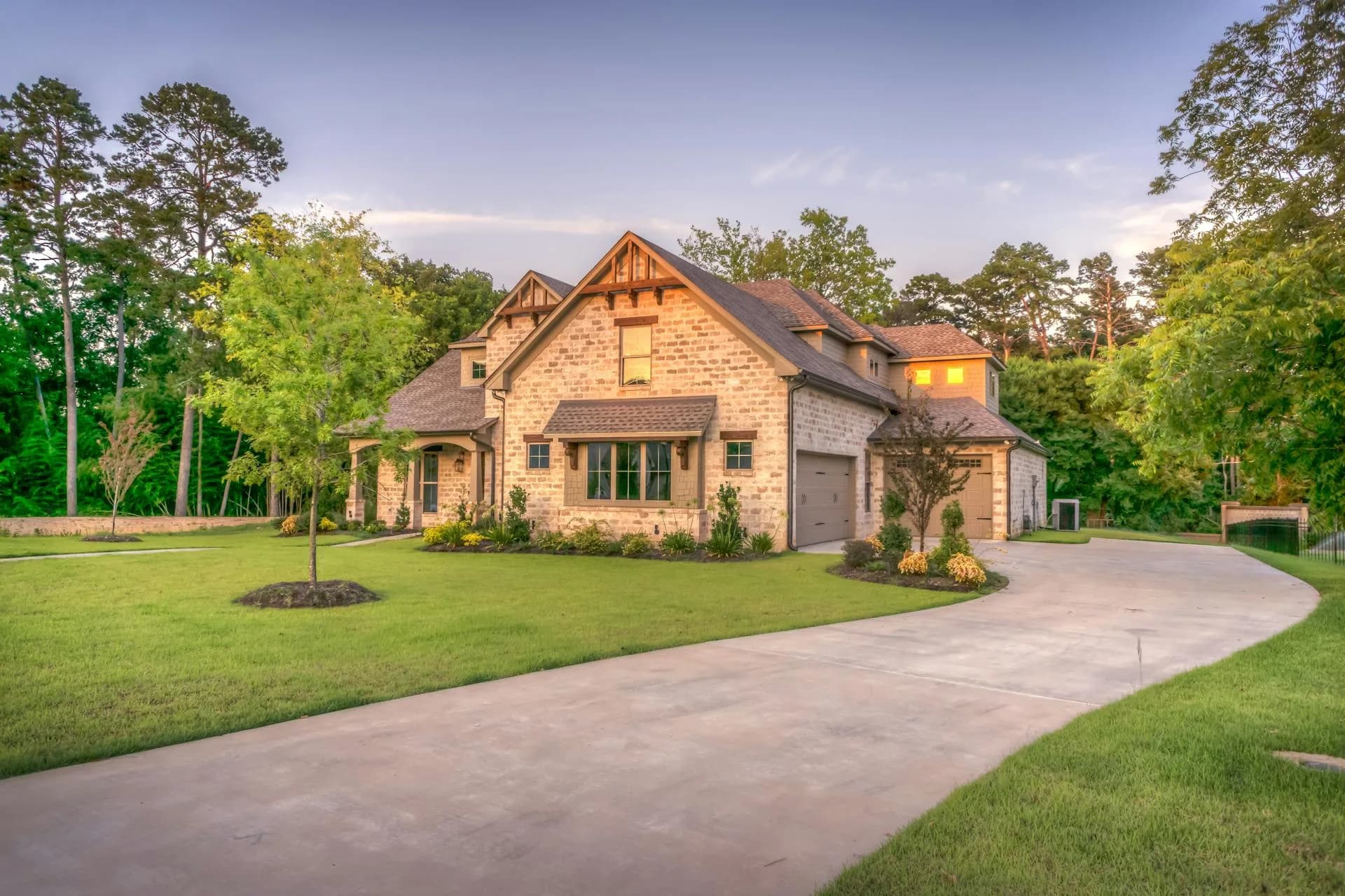
The Chattahoochee forms the western boundary of much of northwest Atlanta and runs through or near Tuxedo Park, Mount Paran, and Whitewater Creek. Properties directly along the river often command premium prices for their privacy and natural settings, but the lots closest to the water may include portions within Zone AE. Many of the largest estates in these areas sit on elevated bluffs well above the flood plain, which is why the specific lot matters more than the neighborhood label.
Peachtree Creek Areas
Peachtree Creek flows through the center of Buckhead before joining the Chattahoochee. Its flood plain touches portions of Peachtree Hills, Brookwood Hills, Garden Hills, and areas along Peachtree Battle Avenue. The September 2009 flood was particularly devastating along Peachtree Creek, where water levels exceeded anything in the historical record. According to U.S. Geological Survey stream gauge data, Peachtree Creek crested at over 22 feet during that event, well above the previous record.
Nancy Creek and Tributaries
Nancy Creek, a tributary of Peachtree Creek, runs through portions of Chastain Park and North Buckhead. While the flood zones along Nancy Creek are generally narrower than those along the Chattahoochee or Peachtree Creek, localized flooding can still affect properties near the creek bed. Smaller tributaries and drainage channels throughout Buckhead can also create isolated flood risk that does not always appear on FEMA maps.
The 2009 Flood: What Atlanta Learned
On September 20-22, 2009, a slow-moving weather system dropped over 20 inches of rain on parts of metro Atlanta in roughly 72 hours. According to the National Weather Service, it was the worst flooding event in north Georgia since record-keeping began. Ten people died, and damage estimates exceeded $500 million across the metro area.
In Buckhead, Peachtree Creek overflowed its banks and inundated properties that had never flooded before. Homes along Peachtree Battle Avenue, Ridgewood Road, and portions of Peachtree Hills sustained severe damage. The Chattahoochee also crested well above flood stage, affecting properties along its corridor.
The aftermath had lasting impacts on Atlanta real estate. FEMA revised flood maps for portions of Fulton and DeKalb counties, expanding flood zones in some areas and contracting them in others. The City of Atlanta invested in stormwater infrastructure improvements, particularly along Peachtree Creek. Property disclosure requirements became more scrutinized, and buyer awareness of flood risk increased substantially.
For luxury buyers today, the 2009 flood provides a useful reference point. Properties that stayed dry during that event have a strong empirical track record. Properties that flooded and have since been elevated or retrofitted may be fine, but they warrant extra scrutiny. And properties that flooded and have not been structurally modified remain higher-risk holdings.
Flood Insurance: Costs, Coverage, and Options
Flood damage is explicitly excluded from standard homeowners insurance policies. If you want flood coverage, you need a separate flood insurance policy, either through the National Flood Insurance Program (NFIP) administered by FEMA or through a private flood insurance carrier.
The NFIP caps building coverage at $250,000 and contents coverage at $100,000. For a luxury home worth $2 million or more, that leaves a massive coverage gap. This is where excess flood insurance or private flood policies become essential. Private carriers like Lloyd's of London, Chubb, PURE, and AIG offer policies with higher coverage limits that are better suited to high-value properties.
Flood Insurance Cost Factors for Luxury Homes
- FEMA Risk Rating 2.0: Since 2021, FEMA has used a new rating methodology that prices flood insurance based on individual property risk rather than just zone designation. Factors include distance to water, flood frequency, building elevation, and replacement cost. This means two homes on the same street can have very different premiums.
- Elevation relative to BFE: The most impactful cost driver. A home with its lowest floor three feet above the Base Flood Elevation may pay a fraction of what a home at or below the BFE pays. This is why an elevation certificate is so valuable during the buying process.
- Private market competition: The private flood insurance market has expanded significantly since 2020. Private carriers often offer better coverage limits and competitive pricing, particularly for homes that score well on elevation and construction quality. According to the Insurance Information Institute, private flood policies now account for roughly 15% of the U.S. flood insurance market, up from under 5% a decade ago.
- Typical Atlanta ranges: For a luxury home in Zone AE, expect $3,000 to $15,000+ annually for comprehensive coverage. In Zone X (shaded), $500 to $2,000. Outside designated flood zones, under $500 per year for a Preferred Risk Policy through the NFIP or similar private coverage.
Elevation Certificates: Your Most Important Tool
If you take one piece of actionable advice from this article, let it be this: get an elevation certificate for any luxury home purchase near a waterway in Atlanta. It costs $300 to $600 and provides the most accurate assessment of a property's flood risk relative to FEMA standards.
An elevation certificate records the elevation of a building's lowest floor, attached garage, machinery, and equipment relative to the Base Flood Elevation. It is prepared by a licensed surveyor or professional engineer and is the document that insurance underwriters use to determine premiums.
Here is why it matters in practice. Suppose you are looking at a $4 million estate along the Chattahoochee that sits within Zone AE on the FEMA map. The map alone might suggest significant flood risk. But if the elevation certificate shows the home's lowest floor is eight feet above the BFE (because the house was built on a bluff), the actual flood risk is minimal and the insurance premiums will reflect that. Conversely, a home that appears to be just outside a flood zone on the map but sits at a low elevation near a creek bed may face more real-world risk than the map suggests.
Some sellers will have an existing elevation certificate on file. If not, your agent can arrange one during the due diligence period. Given what is at stake on a luxury purchase, this is a negligible cost for critical information.
Climate Change and Evolving Flood Risk
FEMA flood maps are based on historical flood data, but the climate is not static. According to the Fourth National Climate Assessment, the Southeast United States is expected to experience more intense rainfall events as average temperatures rise. This means properties that have historically been outside flood zones may face increasing risk over time.
For Atlanta specifically, research published by Georgia Tech's School of Civil and Environmental Engineering suggests that extreme precipitation events in the metro area have increased in frequency and intensity over the past three decades. The amount of rainfall that constitutes a "100-year event" today is higher than it was in the 1990s.
What does this mean for luxury buyers? It means that FEMA maps, while useful, represent a backward-looking snapshot. Forward-looking flood risk assessment should also consider the property's elevation, the quality of local stormwater infrastructure, upstream development patterns (more pavement means more runoff), and the overall drainage characteristics of the specific lot. A property that sits high, drains well, and has robust stormwater management around it is a fundamentally different risk profile than a low-lying property downstream from new development.
Some insurers and risk assessment firms, including First Street Foundation (which publishes the Flood Factor score available on most real estate listing sites), now incorporate climate projections into their risk models. These tools provide a useful supplement to FEMA maps, particularly for buyers with long holding horizons.
Due Diligence Checklist for Luxury Buyers
Before making an offer on any luxury home near water in Atlanta, work through these steps systematically. The cost of proper due diligence is a fraction of the cost of a flood event on a multi-million dollar property.
1. Pull the FEMA Flood Insurance Rate Map
Check the exact parcel on msc.fema.gov. Note the zone designation and the date of the most recent map revision. Maps that have not been updated since before 2009 may not reflect current conditions accurately.
2. Request or Commission an Elevation Certificate
Ask the seller if one exists. If not, hire a licensed surveyor during the due diligence period. This document is critical for understanding actual risk and predicting insurance costs accurately.
3. Research Flood History
Under Georgia law, sellers must disclose known material defects, which includes known flood history. Ask directly whether the property has ever experienced flooding or water intrusion. Check Fulton County records for flood damage claims. Review the NFIP claims history through your insurance agent.
4. Inspect Drainage and Grading
During the home inspection, pay special attention to grading around the foundation, the condition of downspouts and drainage systems, evidence of water intrusion in basements or crawl spaces, and the condition of retaining walls. In Buckhead's hilly terrain, improper grading is a common source of water problems even outside flood zones.
5. Get Flood Insurance Quotes Before Closing
Do not wait until after closing to discover that flood insurance will cost $12,000 per year. Get quotes from the NFIP and at least two private carriers during the due diligence period. If the property is in a flood zone, your lender will require proof of insurance before funding the loan anyway.
6. Review the Flood Factor Score
First Street Foundation's Flood Factor provides a 1-10 risk score that incorporates climate projections and historical data beyond what FEMA maps show. While not a substitute for an elevation certificate, it provides a useful forward-looking perspective on the property's flood risk over the next 30 years.
7. Consult with a Local Flood Risk Expert
For properties in or near flood zones where the purchase price exceeds $2 million, consider hiring a hydrologist or civil engineer who specializes in flood risk assessment. They can evaluate the property's specific drainage, elevation, and exposure in ways that go beyond standardized maps and certificates. The cost ($1,000 to $3,000) is immaterial relative to the purchase price and the potential downside of an unidentified risk.
Drainage Issues Beyond Flood Zones
Not all water problems show up on FEMA maps. Buckhead's hilly topography and aging stormwater infrastructure create localized drainage issues that can affect luxury properties far from any designated flood zone.
Stormwater runoff from uphill development. When properties uphill are redeveloped with larger homes, more impervious surface (driveways, patios, pool decks), and regraded lots, the volume and velocity of stormwater runoff increases for properties downhill. This is a common issue in neighborhoods undergoing significant teardown-rebuild activity.
Aging infrastructure. Many of Buckhead's stormwater pipes and culverts were installed decades ago and may be undersized for current rainfall patterns and impervious surface coverage. The City of Atlanta has been working to upgrade infrastructure, but progress is uneven. According to the Atlanta Department of Watershed Management, stormwater system improvements remain a multi-year priority.
Basement and crawl space water intrusion. Many luxury homes in Buckhead have finished basements that are below grade. Even without river or creek flooding, groundwater seepage and improper drainage can cause water intrusion during heavy rain events. A thorough inspection that includes moisture testing in below-grade spaces is essential for any luxury purchase in hilly terrain.
The bottom line: even if a property is in Zone X (unshaded) with no FEMA flood risk, drainage and water management should be part of your due diligence checklist. Ask the inspector to specifically evaluate grading, downspout discharge, sump pump presence and condition, and any evidence of past water intrusion.
The Bottom Line
Flood risk is a factor in Atlanta luxury real estate, but it is a manageable factor. Some of the most beautiful and valuable properties in the metro area sit along the Chattahoochee River or near Peachtree Creek, and they command those prices for good reason. The natural settings, the privacy, and the mature landscapes that waterfront and water-adjacent properties offer are genuinely rare.
The difference between a smart purchase and a risky one comes down to information. Buyers who check the FEMA maps, get an elevation certificate, research flood history, inspect drainage carefully, and price flood insurance before closing are making informed decisions. Buyers who skip these steps are taking on unknown risk at high dollar amounts.
If you are buying a luxury home in Atlanta and have questions about flood risk in a specific neighborhood or for a specific property, our team can help. We know which streets flooded in 2009, which properties sit on bluffs versus in low-lying areas, and which neighborhoods have the best stormwater infrastructure. Get in touch and we will help you buy with confidence.
Frequently Asked Questions
Are any luxury neighborhoods in Atlanta in a flood zone?
Yes. Parts of several high-end neighborhoods sit within or adjacent to FEMA-designated flood zones. Areas along the Chattahoochee River (including portions of Tuxedo Park, Mount Paran, and Whitewater Creek) and Peachtree Creek (parts of Peachtree Hills, Brookwood Hills, and Garden Hills) may have parcels that fall within the 100-year or 500-year flood plain. The key is checking the specific parcel, not just the neighborhood name. A property one lot away from a flood zone boundary may carry zero flood risk. Always pull the FEMA Flood Insurance Rate Map for the exact address.
How much does flood insurance cost for a luxury home in Atlanta?
Under FEMA's Risk Rating 2.0 system, premiums vary based on the individual property's risk profile rather than just its flood zone designation. For a luxury home in a high-risk Zone AE along the Chattahoochee, annual premiums may range from $3,000 to $15,000 or more depending on the home's elevation relative to the base flood elevation, the building's foundation type, and the replacement cost. Homes in moderate-risk Zone X (shaded) may pay $500 to $2,000 annually. Properties outside any designated flood zone may still choose to carry coverage, often for under $500 per year through the NFIP or private carriers.
What is an elevation certificate and why does it matter?
An elevation certificate is a document prepared by a licensed surveyor or engineer that records the elevation of a building's lowest floor relative to the Base Flood Elevation (BFE) established by FEMA. It is the single most important document for determining flood insurance premiums and actual flood risk. If your home's lowest habitable floor sits two feet above the BFE, your flood risk and insurance costs drop significantly compared to a home at or below the BFE. When buying a luxury home near any waterway in Atlanta, always request or commission an elevation certificate before closing.
Can I get a mortgage on a home in a flood zone?
Yes, but with conditions. Federally backed mortgages (conventional, FHA, VA) require the borrower to carry flood insurance if the property is in a Special Flood Hazard Area (SFHA), which includes Zone A and Zone AE designations. The insurance must be maintained for the life of the loan. There is no federal requirement for flood insurance on homes in Zone X or outside designated flood areas, though some lenders may require it at their discretion. Cash buyers have no insurance requirement, but carrying flood insurance is still strongly recommended if the property has any flood exposure.
How do I check if a specific Atlanta address is in a flood zone?
The most reliable method is to check FEMA's Flood Map Service Center at msc.fema.gov. Enter the property address to view the current Flood Insurance Rate Map (FIRM). You can also contact Fulton County or DeKalb County's floodplain management office for local determinations. Your real estate agent and lender will typically order a formal flood zone determination during due diligence, but it is worth checking early in your search process to avoid surprises. Keep in mind that FEMA maps are updated periodically, and a property's zone designation can change.
Has Atlanta experienced significant flooding in recent years?
Yes. The September 2009 flood was the most devastating in modern Atlanta history, dumping over 20 inches of rain in some areas over a few days. Peachtree Creek overflowed its banks throughout Buckhead and Brookwood, and dozens of homes along the Chattahoochee sustained major damage. According to Fulton County records, the 2009 event caused hundreds of millions of dollars in property damage across metro Atlanta. Smaller but significant flooding events have occurred in 2013, 2020, and 2024, particularly in areas with inadequate stormwater infrastructure. These events underscore the importance of understanding flood risk before purchasing.
Do flood zones affect luxury home resale value?
Research suggests that flood zone designation can affect property values, though the impact varies by market and severity. A 2020 study published in the Journal of Real Estate Finance and Economics found that homes in FEMA-designated flood zones typically sell for 4% to 7% less than comparable homes outside flood zones, controlling for other factors. In luxury markets, the discount may be smaller because buyers are often better capitalized and less sensitive to insurance costs. However, a history of actual flooding on a specific property can reduce value more significantly. Full disclosure of flood history is required under Georgia law.
What is the difference between a 100-year flood zone and a 500-year flood zone?
A 100-year flood zone (Zone AE or Zone A on FEMA maps) has a 1% annual probability of flooding in any given year. Over a 30-year mortgage, there is a 26% cumulative chance of at least one flood event. A 500-year flood zone (Zone X, shaded) has a 0.2% annual probability. These are statistical estimates, not guarantees. A 100-year flood can happen in consecutive years. The terminology is misleading because it sounds rare, but the actual cumulative risk over a typical ownership period is meaningful. Properties in the 100-year zone require flood insurance with federally backed mortgages; those in the 500-year zone do not, though coverage is recommended.
Can I build or renovate a luxury home in an Atlanta flood zone?
Yes, but with significant regulatory requirements. Fulton County and the City of Atlanta enforce the National Flood Insurance Program's development standards, which require that new construction in the Special Flood Hazard Area have the lowest floor elevated at or above the Base Flood Elevation. Substantial improvements (defined as work exceeding 50% of the building's market value) trigger the same elevation requirements. This means a major renovation of a flood-zone home may require raising the structure. Permits, engineering studies, and compliance documentation add cost and timeline. Budget 10% to 20% more for construction in a flood zone compared to an equivalent project on higher ground.
Should I avoid buying a luxury home near water in Atlanta?
Not necessarily. Some of Atlanta's most desirable and highest-value properties sit along the Chattahoochee River or near Peachtree Creek. Waterfront and water-adjacent properties command premium prices for good reason: privacy, views, and natural beauty. The key is understanding the specific flood risk for the exact parcel, not just proximity to water. A home on a bluff 40 feet above the river has a very different risk profile than a home at river level. Thorough due diligence, including an elevation certificate, flood history research, and professional inspection, allows you to make an informed decision rather than avoiding an entire category of properties.

"We found a gorgeous property along the Chattahoochee that we loved, but the team flagged that part of the lot was in Zone AE. They arranged an elevation certificate, flood insurance quotes, and a drainage inspection before we moved forward. Turns out the house sits 12 feet above the flood plain. We bought it with full confidence."
Mark & Lisa H.
Buckhead buyers, Chattahoochee corridor property
Have questions about flood risk on a specific Atlanta property?
Sources
- FEMA - Flood Map Service Center, Flood Insurance Rate Maps, Risk Rating 2.0 methodology, and National Flood Insurance Program guidelines.
- National Weather Service - Atlanta flood event documentation, September 2009 flood analysis, and historical precipitation records for metro Atlanta.
- U.S. Geological Survey (USGS) - Stream gauge data for Peachtree Creek and Chattahoochee River, including historical crest records.
- Fourth National Climate Assessment - Climate projections for the Southeast United States, including rainfall intensity trends.
- Georgia Tech School of Civil and Environmental Engineering - Research on extreme precipitation trends in metro Atlanta.
- Insurance Information Institute - Flood insurance market data, private carrier market share, and coverage statistics.
- First Street Foundation - Flood Factor methodology, climate-adjusted flood risk modeling, and property-level risk assessment tools.
- Atlanta Department of Watershed Management - Stormwater infrastructure data, capital improvement plans, and floodplain management programs.
- Journal of Real Estate Finance and Economics - Research on flood zone impact on property values and buyer behavior.
Flood zone designations, insurance costs, and regulatory requirements referenced in this article reflect conditions as of early 2026 and are subject to change. FEMA maps are updated periodically. This article does not constitute insurance, legal, or financial advice. Consult qualified professionals for guidance specific to your situation.
Disclaimer: This article is for informational purposes only and does not constitute insurance, financial, or legal advice. Flood risk assessments, insurance costs, and regulatory requirements vary by property and are subject to change. FEMA flood maps may not reflect current conditions and are revised periodically. The Luxury Realtor Group is a real estate brokerage and does not provide insurance advisory or engineering services. Consult with qualified insurance, engineering, and legal professionals before making purchase decisions involving flood-zone properties.